
Rossland Historical Land Ownership Map
After over a thousand volunteer hours in the course of the last six years, we’re so excited to launch our Historical Land Ownership Map! Researched and developed by our amazing volunteer Jim Ward, this map will continue to be developed as we learn more about the history of land ownership in our lovely mountain town.
How to Use:
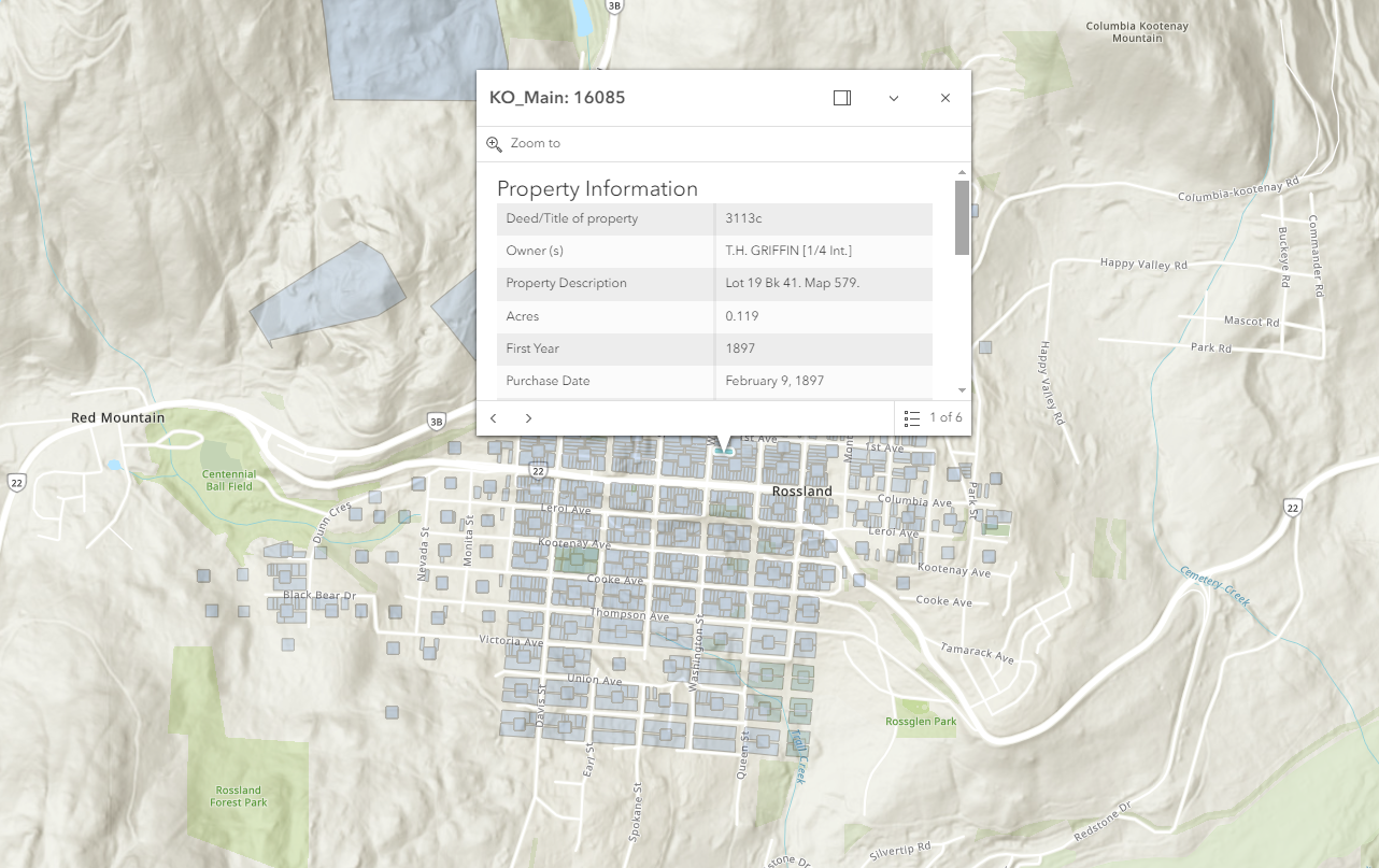
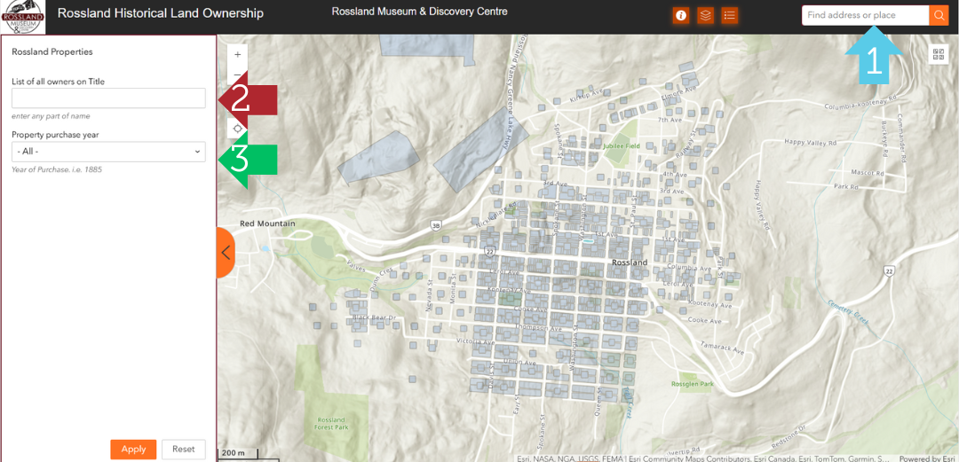
1.) Search by address (Blue Arrow) - Start entering an address (e.g.: 2070 Washington Street) and a list below will display results to choose from. Then click on your choice. This will then zoom to that address. You can then click on the map at that point (or anywhere else for that matter) which brings up a Popup info box. Clicking in the upper right of this box where you see a “1 of x”, (e.g. 1 of 10) a triangle button will take you through the history of ownership of the selected property. Note: it is not yet in chronological order. If you click on the little box in upper right it will anchor the popup in the upper right of the map area.
2.) Search by any part of a name (Red Arrow) - Enter a name (e.g.: Thompson) and press the “Apply” button. This will search the full list of owners of any property.
3.) Search by year (Green Arrow) - Enter a year and press the “Apply” button to get a list of results with a Purchase Date in that year.
Tips & Tricks:
Property outlines: These appear in two ways. Those which are plotted correctly on the Lot(s) themselves [about 20% of results], or as place holders which show as a square shape, in the center of a street block. The second type are in the process of being adjusted to fit the true property shape and location, however this will take some time, and we thought it would be better to have more people represented now.
Search Criteria: When you apply your search criteria, a list will appear in the left panel. You then can click on one of the choices and the app will zoom to that particular property. If more that one property displays on the zoomed in image, then a trick to distinguish specifically the property you have selected, you click on the four dots icon at the top right of the left panel, and then select show selection. This will cause a different color to be applied to that property.
Pop-ups: At anytime you can click on the map and a popup box will appear. Click on the box in its upper right corner to anchor the pop-up in the upper right of your screen. This allows you the see the property history where you clicked on the map.
More than one owner/property: To go through historical property and owner, click on the numbered right/left icon in the upper right of the pop-up. The highlighted image will change to reflect the actual property shape for that particular owner in time. At this point the date order can be a bit random. When finished, just click on the X in upper right. You can then explore other points, or selections from the left panel.
Always click on the Home (🏠) button in upper left of map whenever you want to change a search, as well as the Delete (🗑️) in the lower right of the map if it is displayed there, and in the Search panel on the left. There is also a Reset button in the left panel to click which erases any names or dates you just searched on. This ensures there are no leftover result issues.
Instructions: You can bring up the instruction page on the map at any time by pressing the “Info” button (ℹ️) at the top the website
Happy Exploring!!