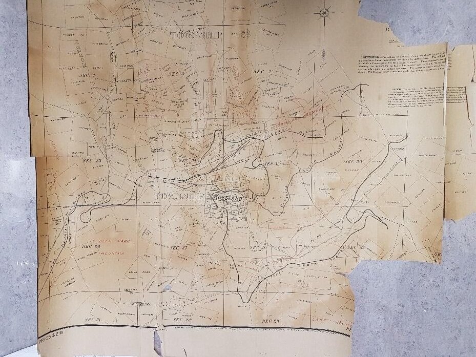
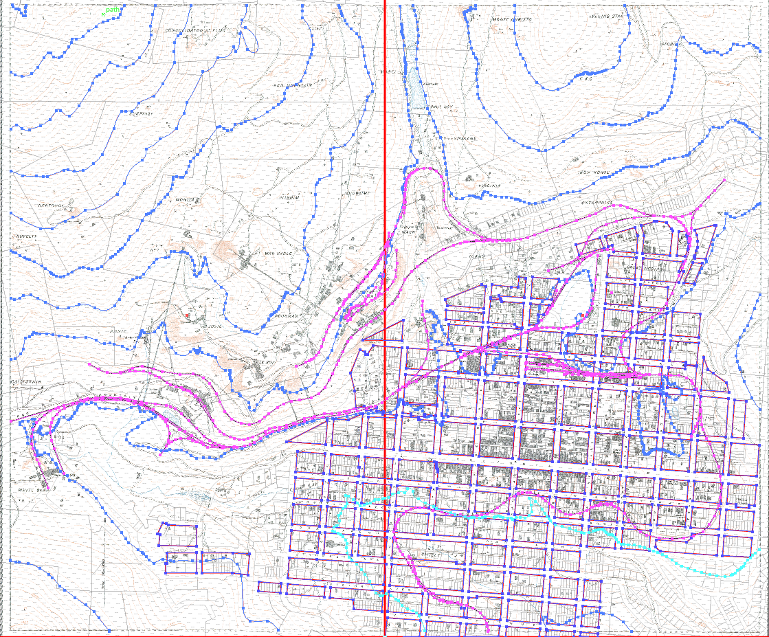
Topographic Map of the Rossland Railways
This model is a laser-cut, topographic depiction of the two railway lines that served the Rossland mining camp - the Columbia & Western (C&W) Railway, and the Red Mountain/Great Northern Railway (GNR). The model is based on a 1908 topographical map of Rossland. The Rossland townsite, major mines, train stations, and train routes are all marked.
This model is on display in the Train Station Outdoor Exhibit at the Rossland Museum & Discovery Centre during the summers and displayed in the J.D. McDonald Hall inside the main Museum building throughout the rest of the year.

Two Countries, Two Railroads, Too Steep!
Fritz Heinze’s Columbia & Western Railway route traveled between Rossland and Trail Creek Landing. Heinze’s railway was nearly 22 kilometres (13.6 miles) long from Trail to the Le Roi Mine. The grade was steep (4 - 4.8% grade) and four switchbacks were needed to get the train up the hill. When the narrow gauge tracks were converted to standard gauge after Heinze sold to the Canadian Pacific Railroad (C.P.R.), two spiral loops were introduced into the switchbacks to reduce the grade. The C.P.R. built a ‘wye’ around Elmore Ave./Butte St. so the C&W trains could turn around.
The Great Northern/Red Mountain Railway route connected Rossland and Northport, Washington which connected to Spokane. D.C. Corbin’s rail line was longer and less steep than Heinze’s, with an average grade of 2.74% and two spiral loops. There was a ‘wye’ for turning the trains on the Black Bear Mine flats (present day site of the Rossland Museum & Discovery Centre).
Other points of interest on this model:
Some of the major mines of the Red Mountain/Rossland mining camp, including:
Le Roi Mine, War Eagle Mine, Centre Star Mine - these mines produced the majority of the gold-copper ore that made Rossland famous.
Centre Star trestle - A high, curved trestle was constructed to carry the C.P.R. track over the Centre Star Gulch to the Centre Star Mine on Red Mountain. This trestle was slowly filled in with waste rock from the mines and now serves as the access road from McLeod Ave. to Highway 3B.
Present site of the Rossland Museum & Discovery Centre on the historic Black Bear Mine site.
Great Northern Railway station and yards: on the flats between Third and Fourth Avenues and Washington and Spokane Streets. There was also a small immigration building on the GNR site where illegal immigrants would be detained until they could be deported. There were also off-loading docks and some large buildings.
Columbia & Western (C.P.R.) station: on the flats between Second and Third Avenues, between Washington and Butte Streets. The C.P.R. yards included a rail yard, a large train station with a long platform, storage facilities, an engine house, and a freight shed.
Building the Model
In the Spring of 2019, the Rossland Museum & Discovery Centre (RMDC) approached the MIDAS Lab about a possible project. The RMDC was working on a new display on the railroad history of Rossland which was to be installed in an outdoor train station exhibit. The puzzle that had been perplexing RMDC staff was how to show the challenging terrain that trains shipping heavy ore in and out of Rossland had to overcome, while also showing the routes of both trains through the townsite to the mines with a high degree of detail. Most of the display options we had been looking into were either going to be huge, out of our budget, or require a level of technology that did not suit the environment where the display was to be housed. Well, we definitely asked the right people!
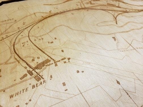
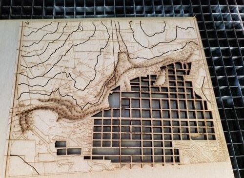
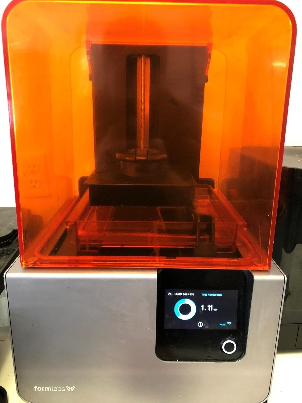
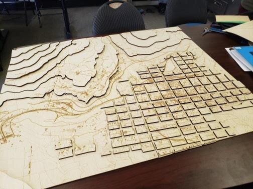
The MIDAS Lab has all the tools and personnel to make miracles happen! Shawn Curran of MIDAS described the process this way: “When the Rossland Museum & Discovery Centre (RMDC) contacted the MIDAS Lab about how to show an interactive railway map, we were excited to collaborate with their great team! Their team has great vision and provided us with ideas and the creative freedom to make a project that would suit their vision and budget. Our main Design and Prototype Technician Ben Marken, a top graduate of the Selkirk College Digital Media & Design Program, had the skills to take a picture file of the map and extract the lines in order to cut them on the laser (Image 1 & 2). We then did a small test cut / etch on the laser with great success (Image 3). The map was so large that we had to split it in half to fit our laser bed and then multiple sheets of high-quality plywood were cut then glued in layers to create the 3D look of the mountains and town site. Signs were also cut on the laser to show the various mines in the area and a trestle was even 3D printed (Image 5) for extra effect. To top it off LED lights were wired in to show the locations of the various mines.”
The experience of working with MIDAS Lab on this project was rewarding and resulted in the creation of an asset for the RMDC, citizens of Rossland, and visitors to our community. Curran reflected on the collaboration, stating: “The team at the MIDAS Lab was very grateful to have been able to work with the wonderful staff at the RMDC and pleased to deliver the interactive map so it could be enjoyed by visitors in time for Canada Day 2019!” The RMDC looks forward to future collaborations with MIDAS Lab.

Special thanks to the Columbia Kootenay Cultural Alliance for their financial support!

Thank you to the team at KAST and the MIDAS Lab (Trail) - now STAC - for taking on this project, including Shawn Curran and Ben Marken!

Continue Outdoor Tour: